We just returned from a really great day trip to Wolf Den Run State Park in Maryland. It was an invite-only volunteer event giving the Maryland DNR one more chance to get feedback from members of the off-road community before opening the 2nd and 3rd parcels of the new state park. By the time this is being published these parts of the park will be open to the public.
We met the Maryland Off Highway Vehicle Alliance (MDOHVA) and Maryland Department of Natural Resources (Maryland DNR) folks as well as the other volunteers at the Huckleberry Rocks area. Once we were all there we headed to the Potomac River Area as a group a few miles away. There we learned about our projects for the day, more about the status of the park, and met everyone.
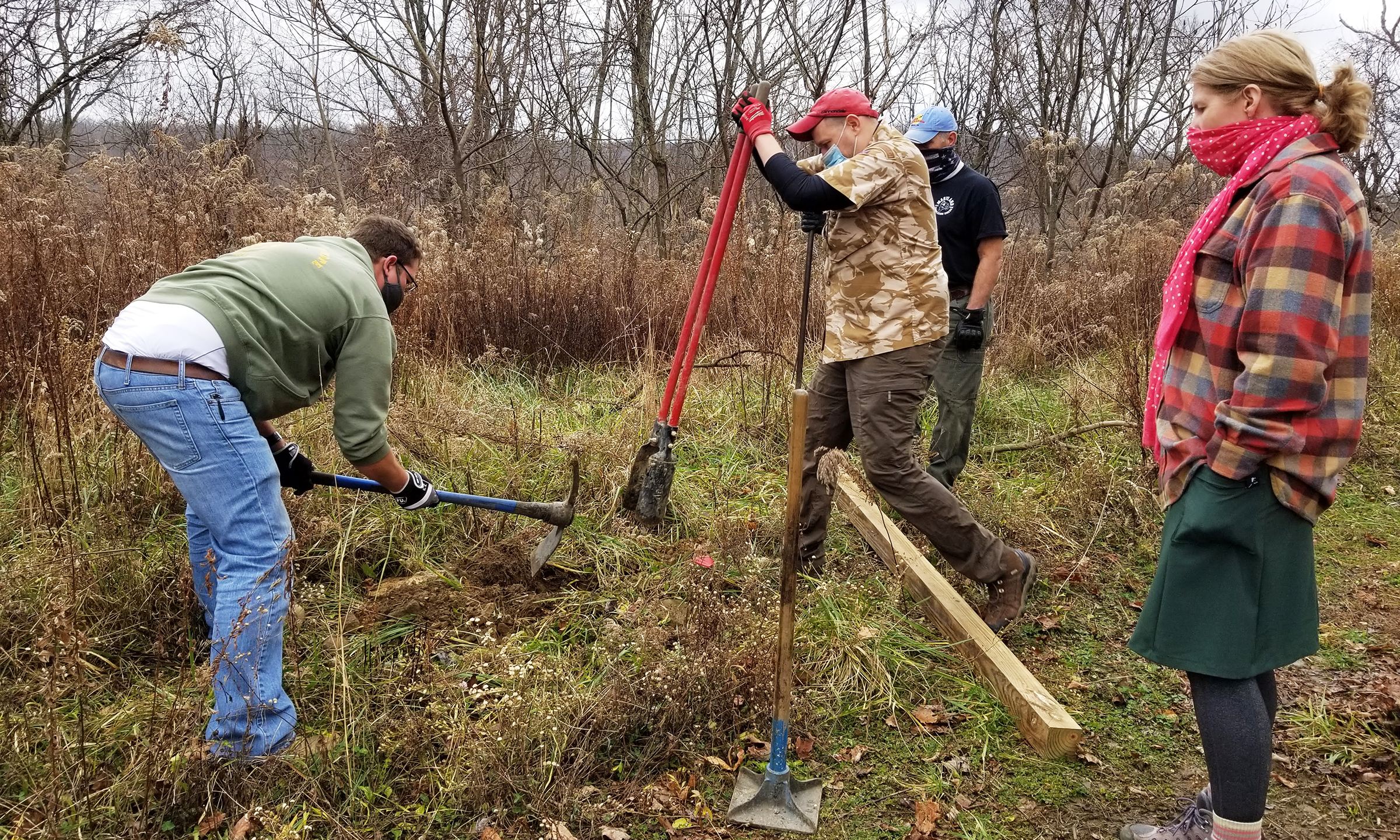
The group was broken into 3 groups with 3 different projects. Our group headed off to install some 4×4’s that would later get signs added to them for trail signage. Another group put together some semi-permanent “saw horses” to be used to block existing trails that would remain closed when the park opened while their use was still being evaluated. A third group would head to another parcel to build fire rings in the future campground.
Each group was supposed to complete their project and then explore the new area and give feedback to the DNR about what we liked and what areas could maybe use more attention. This happened to be the same area that Cherie and I had gotten to explore in 2018 (https://hobbytrap.com/wolf-den-run-swallow-falls/) as well, so it was neat to see how it had been improved since then.
Installing our sign posts took a while since some of the locations had a lot of rocks which had to be removed. But once each hole was 24in deep we put in the posts, oriented them as requested, and then filled the holes back in for a solid sign post! We were leap frogging to tackle the posts in smaller groups but met up with the 2nd half of our group on the trail after we were all done. We ate lunch on the trail then headed off to explore more.
Our group decided to try and explore the black trails to see what the hardest trails looked like. During our exploration we found a lot of random small trees that were just a little too close for full-sized vehicles to make it through. Because we knew we had special permission to clear the trail some we did our part to cut down and clear these small trees and keep moving. There were also a few long portions of trail that had clearly been cleared for quads and side-by-sides but our full-sized vehicles were getting caught on all sorts of vines and branches. For these trails I basically walked ahead of the group with a saw and loppers clearing the trail for the group that followed behind me.
But the highlight was a few sections of the black trails that had a few bigger rocks and stair steps as well as some long steep inclines. We also drove down a trail that basically seemed like we were driving down a stream which was really cool. It had mud and rocks and was just a fun trail.
We gave feedback back to the DNR folks about what we found. Overall we were really excited by what we saw, and we didn’t even finish doing all of the park. We mentioned that the trails were a little tight but overall enjoyable. Also, it seemed like there was a lot of untapped potential that was not currently on the trail network. Areas that would make great future trails. It sounds like the trail network will probably expand in the future, but they want to get the park opened ASAP and get people out on the trails.
Our group was happy to be given the opportunity to volunteer and help out. It gave everyone in the group a bit of a sense of ownership over the park which was kind of cool. We look forward to getting back out there in the spring to finish exploring the park. We did note that the black trails seem like they could be especially difficult in the winter considering the steepness of the trails and the amount of snow and ice that portion of the state gets… so we’ll probably wait until spring.


