What a memorable and beautiful weekend! We decided to start our holiday vacation a little early and took off work Friday. The plan was to drop Ethan off at the grandparents house in Charlottesville and then Cherie and I joined our friend Jendra (see his blog post here) for a weekend of cold weather camping, trail exploration, and wheeling in fresh snow!
The goal for the trip was two pronged. We wanted to explore some of the less popular routes in the area around Flagpole Knob and we wanted to do a cold weather camping trip. Ahead of the trip we planned full day routes for both Saturday and Sunday largely exploring new to us routes that are visible on the George Washington National Forest (GWNF) Motor Vehicle Use Map (MVUM). The MVUM is a great resource for showing the status and location of various routes throughout the forest. One in particular, Forest Road 85-2, was a route that I’d wanted to explore for some time. It goes right along the ridge line between VA and WV and is only seasonally open.
Shortly before our trip snow entered the forecast. With a light dusting Monday before our trip, and then a heavier snowstorm Wednesday evening, we debated cancelling the trip. But the forecast for the area remained all snow, and first hand accounts from locals near the trails showed snow covered trails with no ice. We decided to roll the dice and still try to do the trip. It would either be epic or death defying, and if we got there and saw the conditions would make for an unpleasant trip we were prepared to turn around.
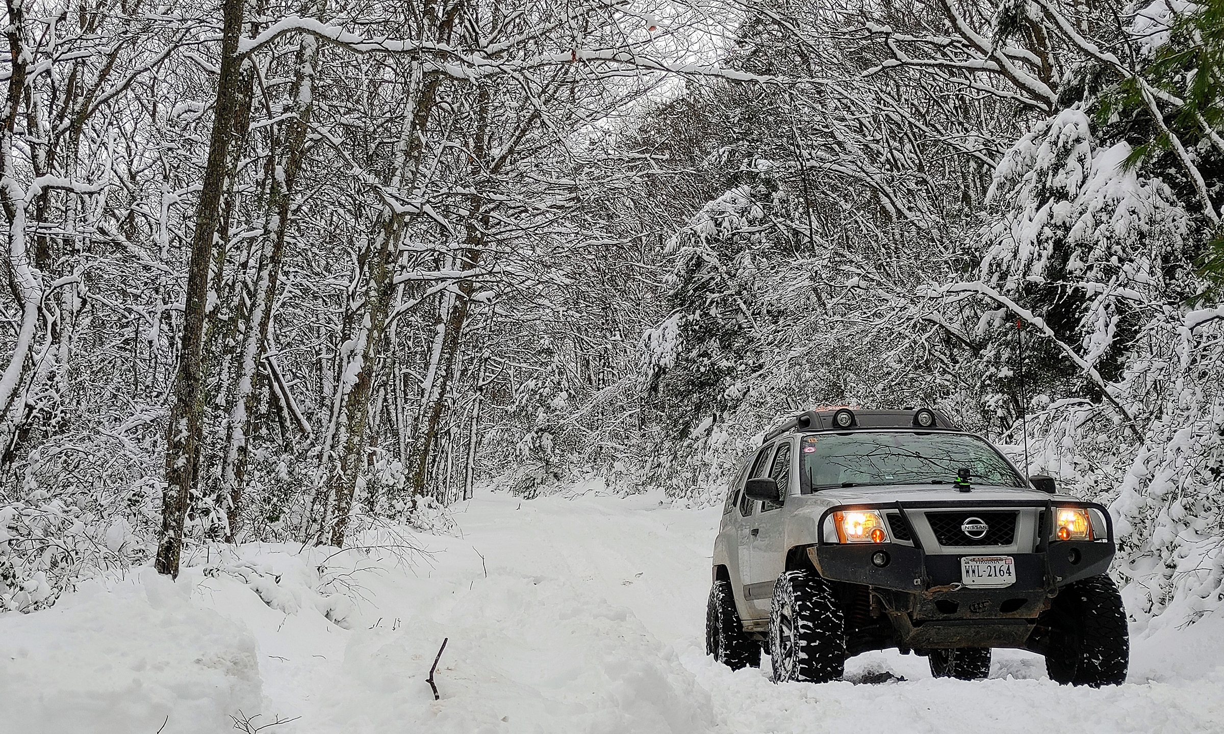
When we turned off the pavement and into the forest we were almost immediately met by several inches deep of fresh snow. Clearly only a few vehicles had traveled on it since it had fallen. We were pleasantly surprised to find we had no problem getting traction! We set off to find our camp spot of choice, finding no other campers anywhere on our way in Friday afternoon. We found the site we wanted, which had no tracks going into it, and setup camp on fresh snow about 6 inches deep.
The depth and presence of the snow created new challenges that we had not faced on previous cold weather camping trips. For example we could only vaguely make out where the fire ring was. Only after having a fire in the ring for two nights, and melting the snow around our fire, did we realize we were burning beside the previously established fire ring! Another challenge was that anywhere you step you made a footprint. Fine outside the tent, but bad under the tent. We figured in the morning we’d sprain our ankles in the tent stepping around a pock marked snow layer under the tent once it froze again. To avoid this Cherie rolled around on the floor of the tent to try and at least partially pack down the snow everywhere to reduce this risk.
Friday night we cooked dinner around the fire and prepared for the first days exploration to come the next morning.
Saturday morning we got off to a slower start than planned. Everyone just moved a little slower than expected in the 20 degree temps on a snow covered site. Our primary goal for the day was forest road 85-2, the Hall Spring Hunter Access Road. This seasonally open route runs along the ridgeline between VA and WV. Off of that route are other routes such as Radar Mountain Trail. Past that we had some other routes planned if we got to them.
Immediately after turning off of US-33 and onto 85-2 we were met with fresh deep snow. While we were not the first ones there after the snow it was immediately apparent this route had far less traffic than the routes around Flagpole Knob where we were camping.
The route itself was very stock friendly, at least with snow on the ground. The trees were still very covered in thick fluffy snow too which made for a very scenic drive. We took our time, with Jendra, Cherie and I all taking lots of opportunities to get lots of pictures and video. We just wanted to try some different shots that you wouldn’t normally want to hold up a whole group to get.
Between the late start, the deep snow, and the slow progress due to our photography and videography exploits though we were way behind schedule when we stopped at the entrance to Radar Mountain Trail for a late lunch. That route had not been driven on since the snow. As tempting as it was we decided we’d need to save that for another day, as well as most of the planned route after 85-2.
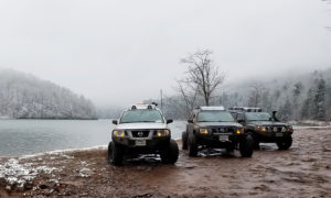
The rest of the drive was pleasant and we had no surprises other than bumping into a 15 vehicle Toyota group at one point that was on Little Dry River Road going the other direction. We made it back to camp before dark, passing the Toyota group again back near our camp where they were setting up at some other sites.
Saturday night we decided that Sunday we would not tackle our planned drive for Sunday. This was due to a handful of factors including that Saturday had been awesome but slower than planned, the Sunday route would include a lot more driving up Flagpole which would remain icy until around noon and had had a lot of traffic over the weekend making the route more ice and less snow. We also didn’t mind the idea of a lazier Sunday morning to eat, pack, and head out.
Sunday we woke up, had a relaxing breakfast and casual breakdown of camp. We headed out before noon. The forest was still blanketed in a thick layer of snow and we were so happy we had rolled the dice and decided to still do this trip despite the surprise snowstorm!
