This past weekend I had a spectacular opportunity to explore an area I have never been to before. Since I was scheduled to be in New Mexico for two weeks back to back I chose to stay the weekend and explore off the beaten path. Due to a last minute change my co-worker Mike ended up staying the weekend too! Sunday another co-worker, Alex, arrived on an early flight and so joined Mike and I for our Sunday adventures.
Saturday in the Santa Fe National Forest
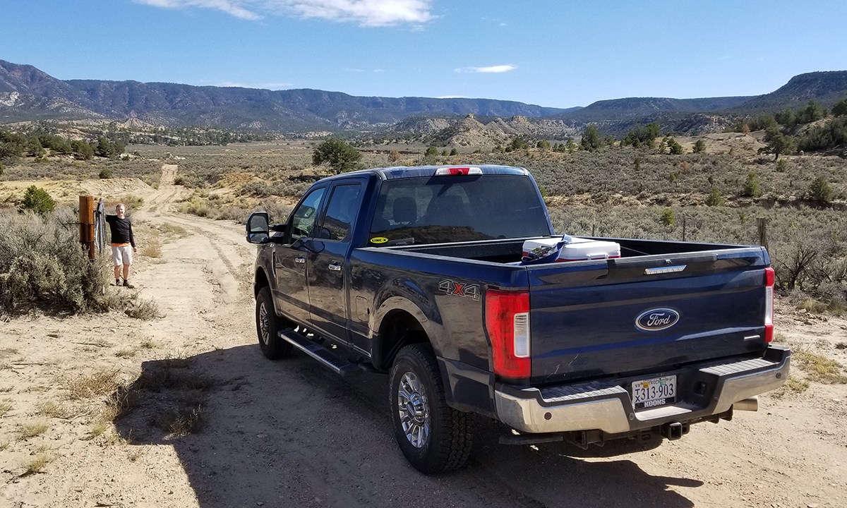
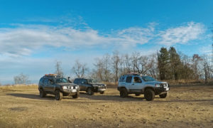
Since we had the company F-250 I wanted to go out a little off road and see an area of New Mexico that I had not yet explored. Mike and I decided to head up to Albuquerque for the weekend and base our exploratory adventures from there. I started doing my research to see where we should go. The New Mexico 4 Wheelers were actually hosting a volunteering effort that weekend, but I decided I’d explored arroyo’s before. Instead I found several roads in the Santa Fe National Forest that appeared to be dirt, not super well documented, but open according to the Motor Vehicle Use Map (MVUM) for the area.
Unfortunately some of the neighboring land was not as well documented since it was Indian Reservation land. I came up with a route with several optional routes on it and a few highlights selected. The plan was to be flexible with whatever we found while we were exploring, but have enough info that we could make our one day count. In my head I had decided that if the terrain got rough enough that I thought I should air down or take off the steps that it was too extreme for the company truck. That being said, I had put a 1600 lb pallet in the bed of the truck at our worksite Friday to soften the ride a bit!
From Albuquerque we headed north on US-550 for about an hour before we planned to hit dirt. This route, once you got north of town, was remote and beautiful! It is a New Mexico Scenic Byway and there were plenty of stereotypically southwest towering land features to enjoy from the road. Eventually we got to my intended exit point from US-550. Unfortunately our first, and second, intended locations were closed with gates. Apparently the Indian Reservations are not interested in strangers crossing their land on the established dirt roads. But no worries, we found another option just a little further north that would lead us into the National Forest.
We turned onto Old Highway 44 and shortly after turned onto dirt. This area was neat to explore and ended up paralleling an arroyo that was probably 20ft deep in places. I’m still kicking myself for not taking a picture of the spot we turned around. The unpaved road dipped down about 7ft into the arroyo. At first glance I though the truck had no chance. But we got out and assessed the situation, and I think it could have made it. I would have done it in the Xterra without hesitation because I could air down the tires to get grip in the soft sandy soil and had a winch if needed. But we didn’t have those things in the truck, and so chose to turn around. I’d recommend this path for anyone else though that is in the area and not wheeling alone. The path looked fun!
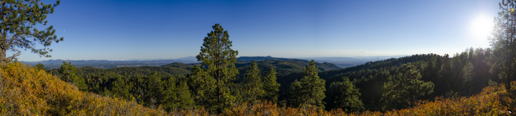
We backtracked back to pavement and went north on US-44 until we could get back on dirt on route 78. From this point on we would see only 2 other vehicles (together) before night would fall. This road would eventually lead us to the base of a road that went up San Miguel Mountain. We decided to take this path clearly not traveled much. Eventually the terrain got to be a little much for us again, so we hopped out and hiked to the top of the mountain. With a peak of 9473 ft I had to pause a few times on the way up. At the top we paused to take pictures and eat our very late lunches which we had brought. The view from the top was pretty awesome. Surrounded by trees you can easily many miles away and see many of those classic southwestern land features again.
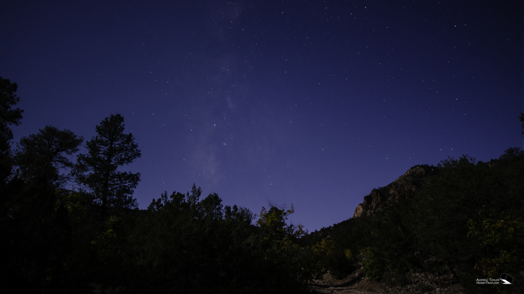
By the time we got back to the truck the sun was getting low and the temperature was dropping. We chose an efficient path back out of the national forest. Shortly before heading out of the forest we decided to pull over so I could try my hand at some astrophotography. The moon was up, but at least about 150 degrees from where the milky way was visible! I spent about an hour in the dark playing with camera settings and eventually got some images that I thought would work. To date this is the best astrophotography composition I have made, shared below.
Just before leaving the national forest we had one more surprise. We got to drive through the Guadalupe Box canyon, and the Gilman Tunnels which are pretty impressive in their own right!
Santa Fe National Forest
Profile
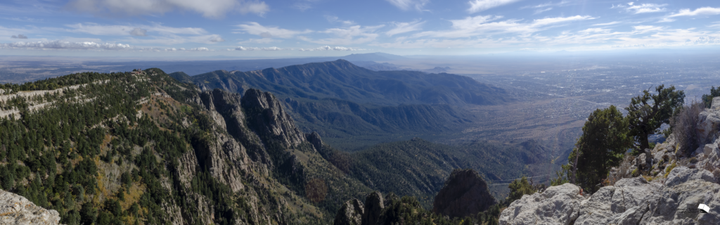
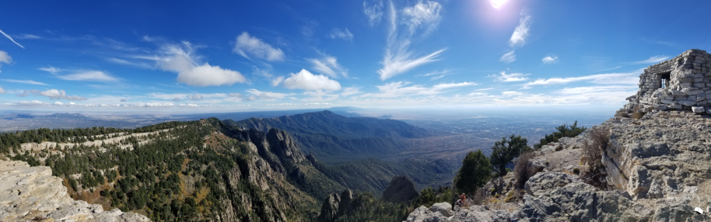
Sandia Peak in the Cibola National Forest
We were a little slow to get up Sunday morning but eventually did and headed out to get Alex from the airport. After picking him up and grabbing some lunch we headed toward Sandia Peak. The Sandia Mountains are a mountain range just east of Albuquerque. The city lies on the relatively flat Rio Grande Rift Valley and is literally in the mountains shadow each morning. In the winter the Sandia Ridge ski slopes are quite popular but in the summer the ridge line is a great spot to explore for the day.
We took the Sandia Peak Tram to the top of the mountain. It takes about 15 minutes and takes you from about 6,500 ft at the base to nearly 10,300 ft at the top! The tram is a feat of engineering which I won’t cover here but you can read more about on their website if you like. After taking the obligatory selfies at the top we were off for a ridge line hike above 10,000 ft!
The route we took from the tram station to the crest was a little over a mile and a half each way. The day we were there was beautiful with clear blue skies and a nice breeze. The breeze attached parasailers which I had not anticipated. They flew overhead and in the valley below the entire time we were there.
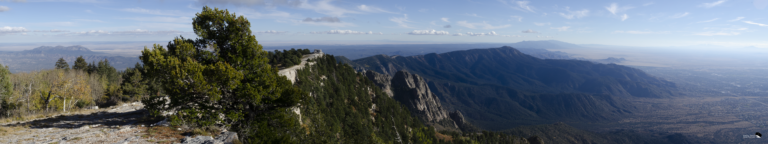
I’m not sure what all to say about the hiking trail along the ridgeline other than the views were constantly spectacular. I had brought along my SLR and did my best to capture the natural wonder that was all around me. Eventually Alex and Mike decided to go for the peak and I decided that I would hang back and get some pictures of the surroundings. Most notably I wanted to capture footage for an HDR panorama of this area, a technique I had never tried before. After getting dozens of images at various exposures I just sat down and enjoyed the view until they returned.
Sandia Peak Hike
Profile
Just an Incredible Weekend
I just can’t get over the beauty of what I saw on Saturday and Sunday. Saturday was spectacular in that I really was exploring an area that clearly is not seen by many. That really makes the experience special in my mind. I would love to go back one day and take the path we had to turn around on. Ideally with friends in another vehicle. Getting to see backcountry like that is always remarkable. And the uniquely southwest view from the top of San Miguel Mountain was really special.
Sandia Peak will also hold a special memory though. The day we went had just perfect weather. It was cool enough to keep you from getting too hot, but not so cold and snowy that it attracted hoards of skiers. The views along the ridgeline were just some of the most beautiful natural sights I’ve ever seen. Paired with a ride on what really is a modern engineering marvel and this trip is hard to beat.
I captured a lot of spectacular footage this weekend but I’ve decided to combine it with my other trips that I’ve had and hopefully will continue to have while I’m working in New Mexico. So I guess look for a highlight video in a few months!
