From our work site in NM we look out over a beautiful landscape and in the distance can see towering mountains. Mike, my coworker, last week mentioned that there is actually an observatory on the top of one of those mountains we’ve been staring at for weeks! He got up there a few weeks before but had arrived as it got dark and turned around at the gate. Last week we had a day where they shut our work site down for the day because of rain and so after doing other things in the morning a handful of us decided to make a trek up to this observatory, the Magdalena Ridge Observatory.
The Drive to the Top
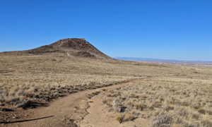
From US-60 we turned south onto Water Canyon Road. At the intersection it’s paved, but a few miles up Water Canyon Road the pavement ended. About 4.7 miles from US-60, at the Water Canyon Campground, the main road turns south and almost immediately drops in quality. Shortly after that there is a sign warning that only high clearance vehicles shall proceed. Sounded like an adventure to me! We were in the company F-250 with 4-wheel drive and ultimately had no issues on this wet but otherwise pleasant day.
The drive up, which from the campground goes about 8 miles before the gate, was an interesting drive. A large portion of it is switch backs with a long drop down on one side or the other. The day we were there we ended up passing through a cloud layer part way up the mountain which was beautiful but also limited visibility for part of the drive. Many parts of the route are wide enough for two vehicles to pass, but not the entire route. We were lucky in that we only ran into one other vehicle coming down the mountain and we saw them at a convenient spot to pull to the side and let them pass.
The drive from the Water Canyon Campground to the top has an elevation gain of just shy of 4000ft. About a third of a mile from the first observatory on the ridge, and on the side of South Baldy peak, the road widens to provide an area to park and turn around because there is a gate limiting travel further by car. The elevation at the parking spot is just shy of 10,500 ft.
Exploring the Observatory
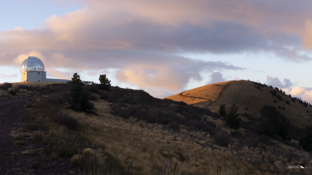
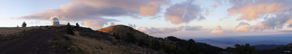
We hopped out of the truck and started walking. It’s clear that the gate is designed to keep cars out but not people since it has a person sized entrance on the side of the gate itself. About a 3rd of a mile from the truck we had made it to the ridgeline itself. The area is perfect for astronomical observations. The area has fairly low light pollution due to its remote location, and with an elevation over 10,000 ft it can look into space with 10,000 ft less atmospheric distortion than a similar observatory at ground level.
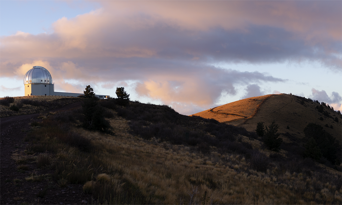
Our first treat was a fairly traditional looking astronomical observatory that apparently houses a 2.4m telescope designed to track fast moving celestial objects such as comets and asteroids. It’s a fairly new building which was first turned on in 2006 and has been in operation since 2008.
Continuing along the ridgeline we got to see the interferometer that is currently under construction. The interferometer will be used to produce images of faint and complex astronomical objects with over 100 times the resolution of the Hubble Space Telescope. It was neat to see this under construction but I guess I’ll have to come back later to see the final product!
Exploring the Irving Langmuir Laboratory for Atmospheric Research
We kept walking south along the ridgeline and eventually came to quite a surprise. The Irving Langmuir Laboratory for Atmospheric Research. When I got back to the hotel I would learn that the laboratory was built in the 60’s and ever since has been used for research into thunderstorm formation and life cycles and various phenomena associated with thunderstorms such as lightning and hail formation. Because of the location and altitude the site apparently is frequently within isolated thunderstorms as they form and remains inside of them until the storm completely subsides!
The facility was a gem though. Immediately after passing the sign for the laboratory we felt like we had walked back into the 60’s. Across the site there were collections of buildings, vehicles, test equipment like generators and more, all looking frozen in time from the earliest days of the cold war.
The jewel of the area was the main research building at the southern edge of the high section of the ridgeline. This facility was just a little over 1 mile from our parked truck. The whole building just screamed 1960’s research center. The architectural choices as well as the shape and type of instruments attached to this facility really were neat to see in person but dated the facility to a very specific time period. While it was clear that it was still used and glancing through the windows showed us a building that still had power and some newer looking equipment, I can only imagine what it was like in its prime. I would love the opportunity to come back and sit inside the facility one day during an active thunderstorm and ride it out from within the clouds!
Sunset on South Baldy
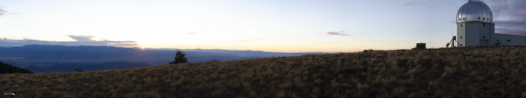
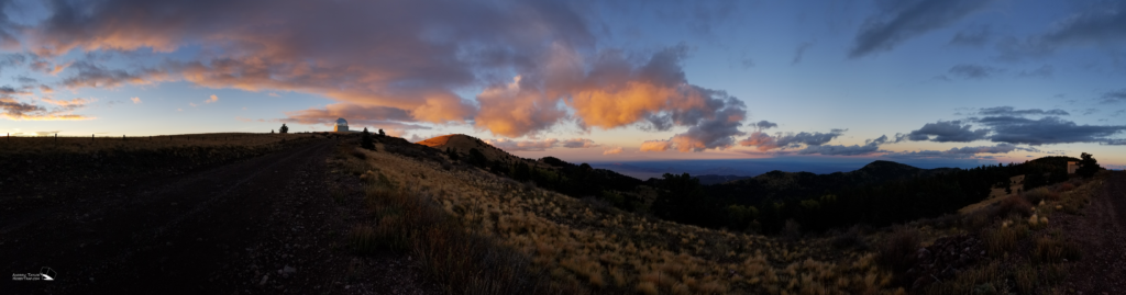
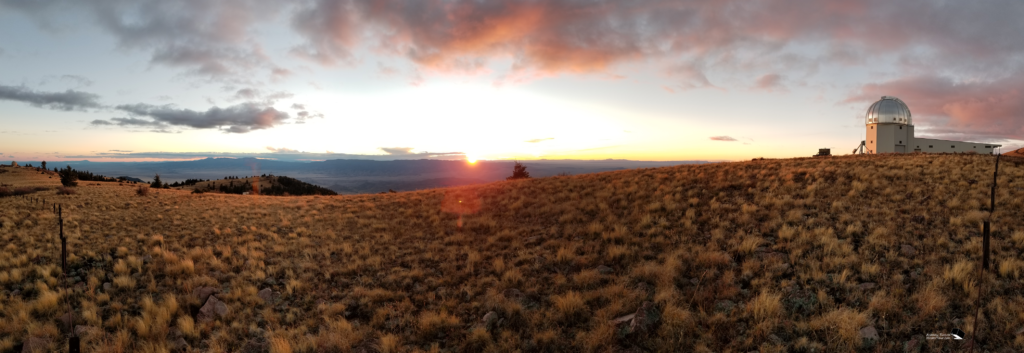
The sun was getting low though so we decided we better start the hike back. Although we had only covered a little over a mile since parking the truck the hike was tiring with the mix of high elevation (all over 10k feet) and that the ridgeline is hardly flat, with elevation changes across the site. As we got back near the 2.4m telescope we were treated to a beautiful sunset. The sky was just full of cotton candy pink clouds and it was surreal to be enjoying the view of the observatory at 10,000ft with that as the backdrop.
Mike, ever the mountain goat, informed the group that he intended to make it to the peak of South Baldy before heading back to the truck. South Baldy is the peak of this ridgeline with an altitude of 10,679ft. Of course that meant the rest of us would climb it as well!
From where you leave the dirt road to the peak was only about a half a mile but you feel each foot gained as you climb the last 200 ft to the top! The temperature was also dropping rapidly as the sun was setting and the wind was really picking up. I paused several times to catch my breath and take pictures so was the last one to make it to the top. I took a few shots from the top, including the not so flattering selfie, and then headed back down.
By the time we were all in the truck we were cold and stiff and it was completely dark outside. Turning the large truck around was a hint of a challenge but with spotters we got it turned around without drama. The drive back down the mountain was long and we were all fairly quiet. If you’re not comfortable driving on a shelf road in the dark I wouldn’t recommend this night drive. But I don’t think any of us can thank Mike enough for sharing the observatory with us that we didn’t know was there!
Hi Andrew, Just saw you time lapse of your trip up to the MRO. My production company filmed up there in 2016, and got a guided tour..we are currently shoe-stringing a pilot for a TV show we hope to get distribution on, at sometime in the future. We normally shoot a time lapse of the journey to our destinations in our show, but we didn’t get a time lapse for that trip. I was wondering if we could use your time lapse? if so, we would give you a nice credit in the segment, unfortunately we have no budget to… Read more »