As with most trips for us to the Outer Banks of North Carolina a hurricane nearly derailed this trip, this time before it even began. (See last years brief trip!) Just a week and a half before we were set to arrive to our rented vacation house in Waves, NC hurricane Dorian descended on the Outer Banks of North Carolina, devastating the island community of Ocracoke, and causing plenty of damage just to the north as well. There was only minimal damage to our rental however and so we decided to go down and enjoy ourselves, support the local economy as best we could, and make memories as we had intended.
This was a great trip! This year we were splitting a 7 bedroom house among 4 couples. My folks Bob and Sue, Cherie’s folks Sid and Linn, Cherie’s sister Nikki and her husband Adrian, and finally Cherie and myself. We also had 2 dogs, Ivan and Roxy. Oh, and our unborn child, going by Cletus the Fetus!
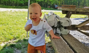
Saturday on the way there Cherie and I had to stop at Diggers Dungeon. This year we decided to get a little toy for Cletus, a small plush Grave Digger monster truck. On the way my parents apparently stopped to enjoy some cotton fields and managed to get to the OHV permitting office early enough to get a permit. We all arrived to the house within minutes of each other, and so after moving into the house went out for dinner at nearby Watermen’s Bar & Grill. That night we discovered the mosquitos were shockingly thick this year when the wind wasn’t moving. A fact that didn’t hamper our week too much, but did weigh in throughout the week.
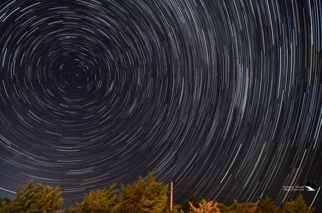
I got my camera equipment out that night and played with some astrophotography but did it at the house, so the pics didn’t come out great.
Sunday
Sunday was mostly laid back. We went out for some groceries, had our first dips in the COLD swimming pool, found time to try out the pool table (I brought my own cues of course), enjoyed our first fresh seafood, and just caught up.
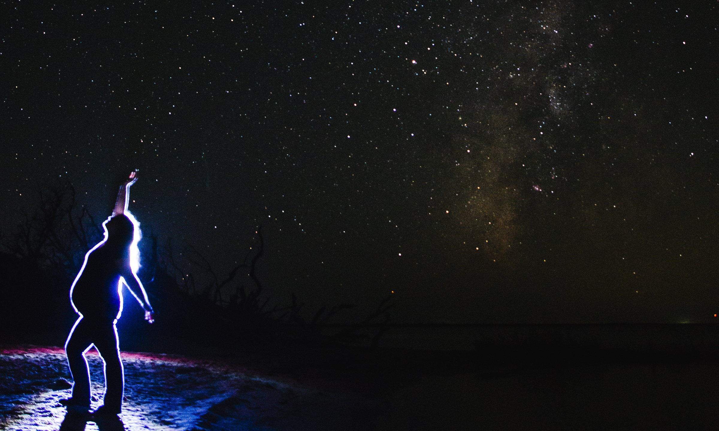
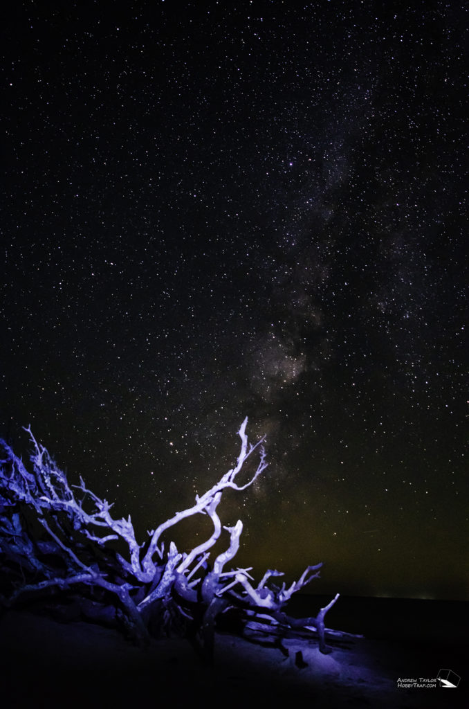
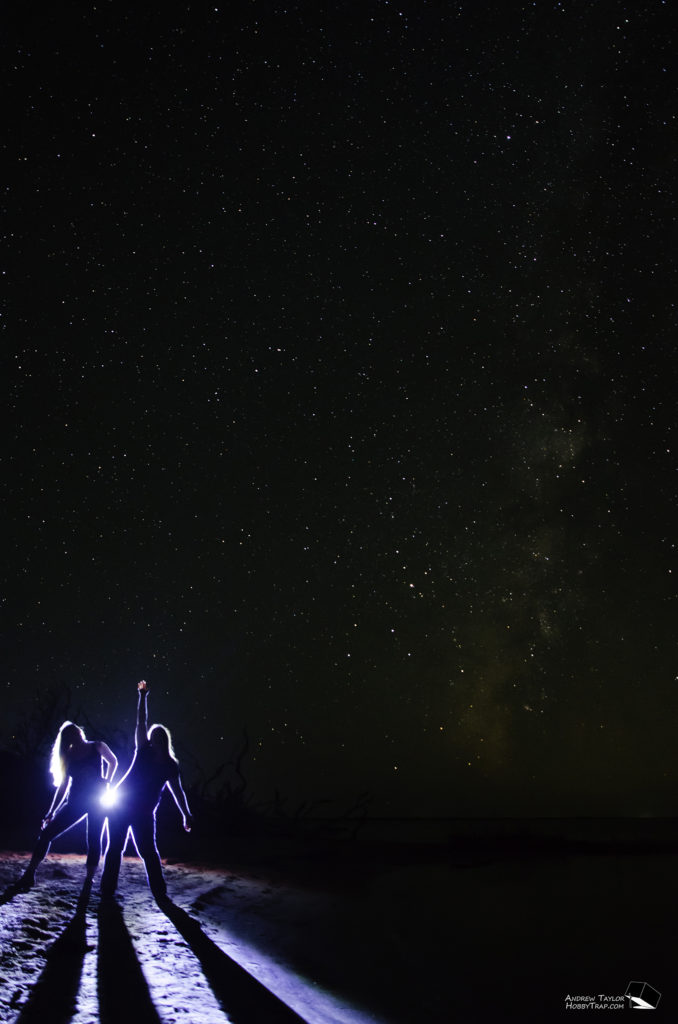
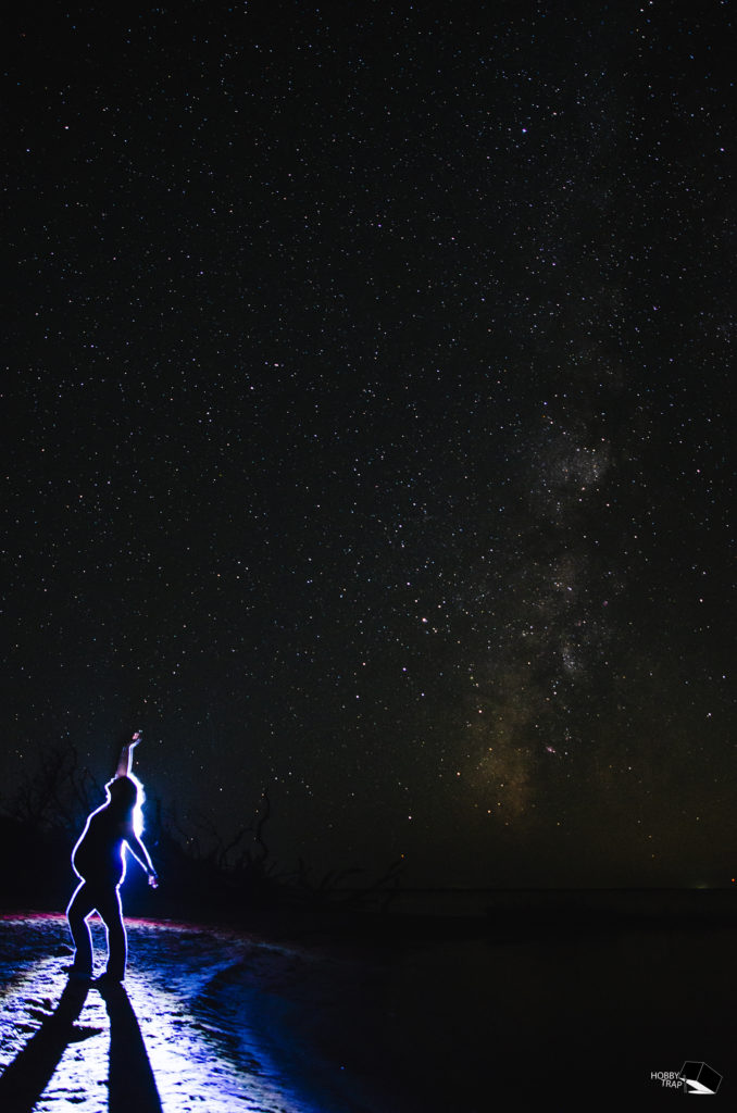
That night Cherie, Nikki, and myself went off to try our hand at some actual astrophotography! The conditions would be nearly perfect for several nights during our stay, but I wanted to make sure to take advantage of each one! After sunset we headed south to the nearby Salvo Day Use Area. We found a small beach on the sound side that seemed perfect. Long story short we took a bunch of pictures, played with a bunch of settings, and in general had a good time. Eventually we had the idea to have some fun with our surroundings and took some more artsy pics including some really cool backlit photos!
Monday
Monday most of us headed north to get our OHV permits at the Bodie Island lighthouse. While we were there my Dad took some time to get some drone shots of the lighthouse from a legal distance. We also enjoyed the nature walk nearby and saw a water moccasin in the water! Afterwards, with permits in hand, we immediately headed directly across the road and got on the beach at ramp 2. Sid was probably the most excited in the group to take his still fairly new pickup truck offroad on the beach for a second year! We drove south until we got to the Oregon inlet. The sand had spread way out this year and we had a huge beach to ourselves and a great fairly close view of the outgoing Bonner Bridge and the new Basnight Bridge. The whole operation, especially this close when you could really take it in, is really impressive. Civil engineering at it’s finest!
Tuesday
Tuesday we set out around lunchtime for the days adventures. After another meal of fresh seafood we went to Hatteras Jack’s for some saltwater fishing gear. We got more help than we could have asked for, including recommendations on bait and the type of bobber combo that works for saltwater fishing. They were even able to load the reels on Cherie and I’s fishing poles with a cool reel filling machine!
Then we were off to find local beading distributors in Avon for my Mom, and a coffee shop for my pregnant wife! Or me… the coffee may have been for me. From there we headed south and back onto the beach at access point 38. It was an out and back endeavour for only a mile, but it was fun. The sand was soft and the tide fairly low. On the way back to the house we also hit the beach from ramp 27 to just north of 25, and back out at 25.
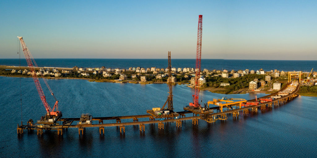
For evening entertainment my Dad and I went out to the southern end of the new Jug Handle bridge under construction and he flew his drone! The spot was pretty neat, and while he was focused on getting good shots I took in the magnitude of what they were doing. The new Jug Handle Bridge is just a massive bridge project, jutting out into the Pamlico sound to make a permanent roadway around the New Inlet which has opened and closed several times in the last 300 years cutting off Hatteras Island from the islands to the north. The other major goal of the bridge project is to have minimal impact on the Pea Island National Wildlife Refuge which sits between the new bridges two ends. The pictures my dad got were pretty cool, and a unique perspective I doubt many would think to take.
Before bed Cherie and I would play a few games of pool on the table downstairs. It wasn’t a great table, only 7ft and pretty banged up, but I just can’t ever get enough pool!
Wednesday
Wednesday morning, before everyone was up, Cherie, Sid and myself headed out for some fishing! We headed to the Salvo Day Use area, sound side, and waded in. Sid and Cherie waded much further than me, until their shorts were soaked… I found the water to be shockingly shallow, but still stuck to the edges to avoid getting my clothes wet. We had a good time, and plenty of nibbles, but it appeared that our bait was not appropriate for the fish we were encountering. None of us managed to pull anything in.
After fishing we headed back for a day mostly around the house. Most of us got in the pool, or parts of ourselves in the VERY COLD pool. Overall though it was a “hang around the house and enjoy the local beach” kind of day.
Nearing sunset I decided to head out to poke into a few of the sound side 4×4 access points. Cherie and my folks decided to join. We went the whole way down to Buxton and then backtracked hitting most or all of the 4×4 access ramps. The highlight was probably the Little Kinnakeet Life-Saving Station. The building was neat, and we learned more about what these life saving stations were all about. Hard to imagine your job being to live on a beach in the middle of nowhere, and during the worst storms, which would often damage ships, you were to head out in a row boat into the ocean and see if you could save anyone.
The access ramp continued past the old building though and wrapped around to the sound side. There we found a small beach. With the wind calming down the mosquitos were super thick, but so was the army of dragonflies no doubtely picking them off. While out of the car for a few minutes we enjoyed what was probably the prettiest sunset from the entire trip.
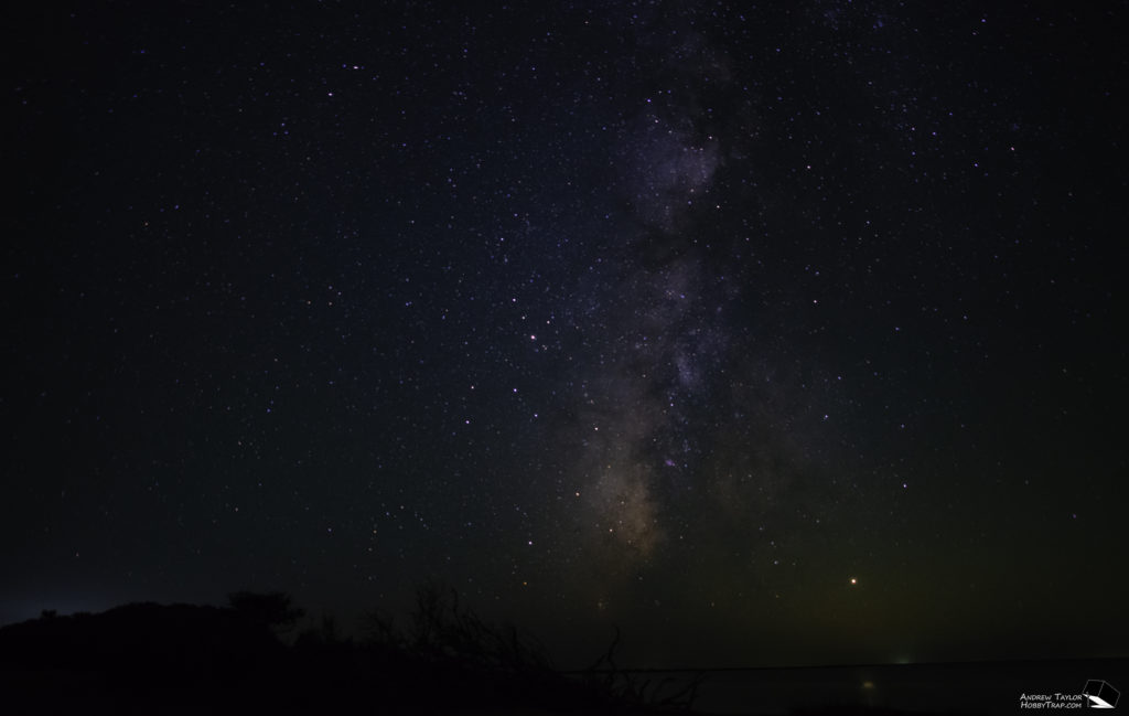
That night Cherie and I headed back down to try one more time to get good astrophotography shots with the Cape Hatteras Lighthouse. I give up! There is a poorly placed radio tower not too far behind it that ruins any shot facing east unless you put yourself in just a few specific vantages to avoid its blinking red light. On top of that the lighthouse itself creates a ton of light in a never ending sweeping motion.I tried for about an hour to get something that would be good including trying light painting techniques… but I just never got what I was after.
Thursday
For breakfast we headed down to the Orange Blossom Bakery in Buxton to get their famous Apple Uglies! They’re not much to look at, but despite their size no one seemed to have any left when we prepared to leave.
After breakfast we headed to Hatteras to visit the Graveyard of the Atlantic Museum. On the way we saw crews working to pick up storm debris left by residents along the road. The further south we went the more debris we seemed to find. While this island wasn’t hit as bad as Ocracoke just to the south they had clearly been hit pretty hard as well.
Somehow in all the years we’ve been coming down here none of us had made it to the Graveyard of the Atlantic Museum before. For me the highlight was just inside the front door. There they had the original fresnel lens from the Cape Hatteras Lighthouse. They had several panels talking about the history of the lighthouses that have been on this island over the years, and the various upgrades along the way, as well as various specs of the lighthouses. The history of how it grew and changed over the years was fascinating.
Inside the main exhibit hall there were various shipwreck related exhibits. I was actually underwhelmed by the museum as a whole. They had some interesting history of the area, a temporary exhibit on Blackbeard and his ship, and even a small permanent exhibit with artifacts from the Titanic, but overall I was disappointed by the collection.
Leaving the museum we headed south and east, onto the beach at ramp 55. Just after we got onto the beach we discovered the remains of a shipwreck! The remains were about 20-25ft long and well above the high tide line. It happened to also be right next to a turtle nest which we checked out from outside of the safety ropes. The tide was high and the beach was surprisingly popular the further south we headed. Eventually we ran out of beach and backtracked slightly to a crossover that went to a sandy beach access road that ran parallel to the beach but closer to the sound in many cases. We took it to the far end of the island until we hit water again. We headed back and hit pavement at the museum.
Heading north along 12 we headed back onto the sand at ramp 49. We would stay on the beach for over 2 hours, eventually finding our way the whole way down to Cape Point. As is always the case the point was very popular. It was super windy and the entire edge of the point was lined with people fishing. We pulled out our poles and tried our hand at catching something.
While we fished the person to our immediate left hauled in a 3ft shark! About 15 minutes later the guy immediately to our right hauled in a 4.5ft shark! After both sharks were released back into the water, and we watched the pelicans feasting on the school that was clearly beyond our casting reaching, we decided to call it a day on the fishing to avoid catching a shark. The pics of Cherie fishing that afternoon in her nicer casual beachwear, baby bump and all, was quite the sight.
Friday
I started the morning on a poor note… I discovered a puddle of oil on the driveway under the Xterra. Of course this would have to happen the day before we were scheduled to leave. A local mechanic diagnosed it quickly as a rear main seal and said to just watch the oil level on the way home. We would get home and they were actually discover there was water in the front diff and that it would need to be rebuilt, a cheaper fix but still not free. Anyways, our beach driving was done for this trip.
We discovered it on our way out the door though for an early morning beach walk. Cherie and I decided to take a stroll down the beach before everyone was up. This started exciting with a handful of F-15 military jets shooting by as we got to the dunes! We ended up walking about a mile, the whole way to the Rodanthe Pier. Cherie would have worn her pregnancy support belt had we known we’d walk a mile at the outset but we did not. We ended up calling my Dad to come pick us up in the truck so we wouldn’t have to walk back.
After lunch we went back and hung around the house for the majority of the day. A little before sunset a handful of us went down to the beach to enjoy our last evening at the beach. We flew my Mom’s butterfly kite but never managed to get my stunt kite up into the air effectively. I don’t know what it is about kites but I just enjoy flying them. Eventually I would take over flying my Mom’s kite!
Saturday
Our last morning Cherie and I decided to head back up to Rodanthe Pier, this time by vehicle. We figured we try our hand at some sunrise beach pics. While the clouds didn’t really cooperate it was still a nice morning to get our and enjoy the beach one last time.
Back at the house the arduous process of packing to leave began. I took a small break from that to air up the tires on all 3 beach driving vehicles to prepare them for the long drives ahead. My hands-free automatic tire inflation regulator seemed to work well and continued to impress me! It allowed me to setup 2 tires at a time and not worry about them for a few minutes while I brought loads out to the vehicles.
After saying our goodbyes we each headed home in our way. My folks headed South to get some aerial shots of the Cape Hatteras Lighthouse (a logistically tricky task to do legally) as well as see where they were taking the storm debris. Cherie and I would head north, stopping for a while at the Wright Brothers Memorial and seeing inside which has recently been reopened. We even saw a huge string of Jeeps stop by for a few minutes from the local Jeep Show! Then we would hit nearby Goombays Grill for lunch, one last meal of seafood, before getting on the road. Nikki and Adrian and Sid and Linn were quicker to get on the road and stay focused until they got home.
Monday
Profile
Tuesday Track A
Profile
Tuesday Track B
Profile
Wednesday Track A
Profile
Wednesday Track B
Profile
Wednesday Track C
Profile
Wednesday Track D
Profile
Wednesday Track E
Profile
Wednesday Track F
Profile
Thursday Track A
Profile
Thursday Track B
Profile
Hurricane Dorian Storm Cleanup
The people and communities of the outer banks of North Carolina are robust because they have to be. They are annually hit with storms that can, with short notice, turn their world upside down. After each storm the communities face an odd problem. When to re-open to tourism which the area depends on to survive. After Dorian many house rentals were not available for a week and a half, but when our week came up we were told the house had minor damage but that the state of emergency had been lifted, our deposit would therefore not be reimbursed, and that there was no reason not to come down to enjoy our vacation home.
Once we got down there we saw first hand the piles of debris lining NC-12, waiting for disposal crews to remove it, move it to a temporary storage area, and eventually presumably dispose of it off the island. For those lightly hit by the storm they welcomed tourists back with open arms, available and eager to receive the income these late season tourists represented. But to those that were hit harder by the storm they faced tourists increasing traffic on the roads and competition for goods in the stores, and bosses calling them back to work while they struggled to repair their homes. If tourists weren’t let back onto the islands until everyone was back at 100% the wait could cost everyone millions of dollars, but do it to early and it causes problems for everyone.
I present the following gallery as simply an eye opening experience of what we saw first hand. First are images of the damage still present on our rental house. While there was no damage that affected our ability to enjoy the house we were aware of the flapping tarps that had been hastily applied after the storm. The images also show piles of storm debris, damaged appliances from homes, water damaged building materials, etc piled along the roads. They show the crews removing those piles into trucks to take elsewhere. My Dad took his drone to one of the areas where they were temporarily collecting this debris, to get it out of the way and off the roads quickly, but wouldn’t require each truck load to take the long journey north off the island to dispose of it’s load. Finally just one image of one of the many large pieces of earth moving equipment we saw actively trying to repair the dunes and clear sand off of NC-12.
Update: On Monday, December 2nd, nearly 3 months after Dorian descended on Ocracoke, the evacuation order was lifted. This meant that visitors could finally return to the island. But in addition to the vacations that can now go on as planned it’s easy to forget the island that has taken 3 months to recover enough, but not completely, to get back to a point where they can support tourism.
While the OBX communities continued to rebuild a new storm has also recently hit. A Nor’easter pummeled the outer banks in mid-November, breaching the dunes at each high tide, and stranding motorists and their cars on NC-12 as the road became impassable again and again. The DOT crews worked to repair the dunes and re-open NC-12 over and over again, only to gain short windows of use before the waves would close it again. From this too the communities have now recovered, but it is a reminder of the never ending struggle for those living and visiting the outer banks of North Carolina.
Thanks to the following folks for helping to take pics and video featured in this write-up! Cherie, Bob, and Sue Taylor, Sid Wood. All aerial shots were courtesy of Bob Taylor.
