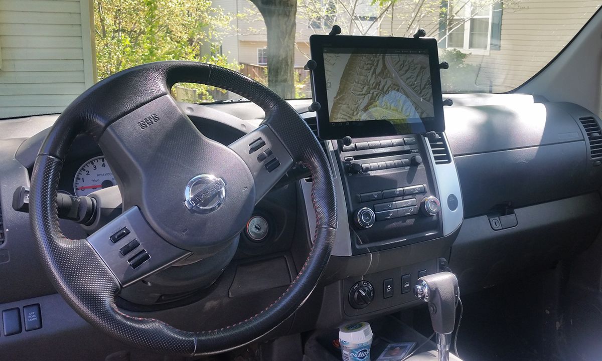
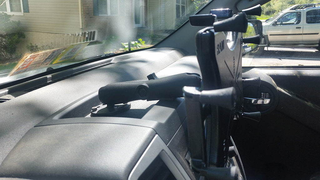
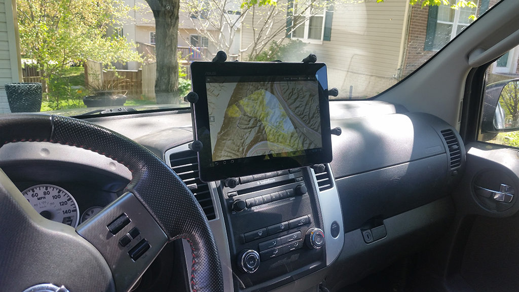
This is how I mounted a 10in tablet to my dash. I find this much more convenient than a phone for long trips and especially trips off road. This mount has been in place for years, surviving tens of thousands of miles on and off road. You can use the tablet to show off-grid navigation apps where the maps are pre-downloaded. This is super useful for camping and off roading as well as just navigating in more remote areas. You can also use this to display digital maps of places like State and National Parks using apps that show your location in real time on the normally paper map! For off road parks the maps are great, and show the color code for trails and stuff, but the tiny screen on a phone means I was constantly flicking the map around while driving.
Parts List
I’ve had a lot of success with Ram Mounts for personal and professional projects so that’s where I decided to get my parts. Also note that these pictures and part list are to complete this installation in a second generation Nissan Xterra. The parts list would be similar if you’re in a Jeep or Toyota or something, so just keep that in mind. Here are the parts I used.
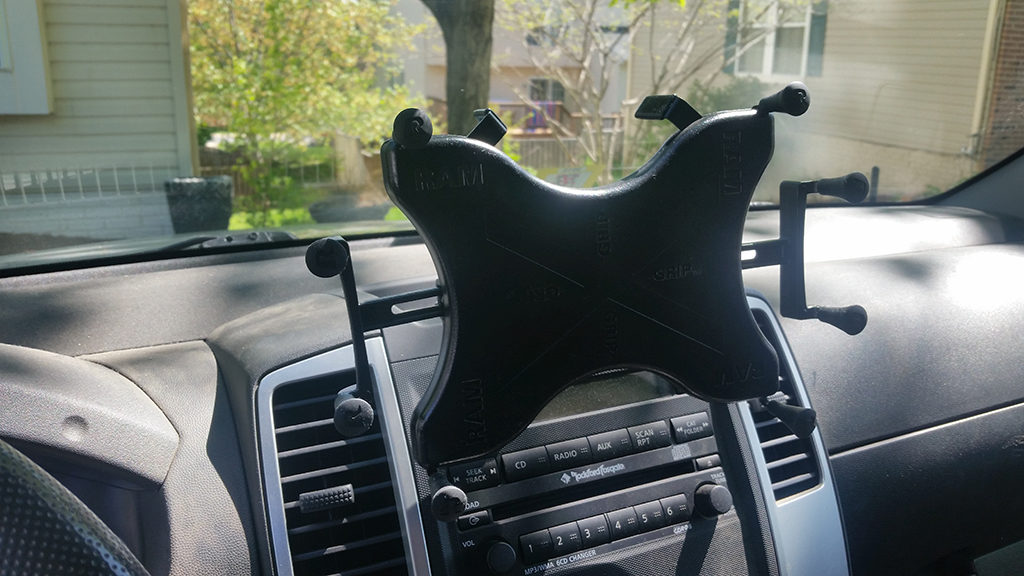
- Ram Mount X-Grip III for 10″ tablets – part number RAM-HOL-UN9U (Amazon listing here)
- Ram Mount Ball Mount with Long Double Socket Arm – part number RAM-B-101U-C(Amazon listing here)
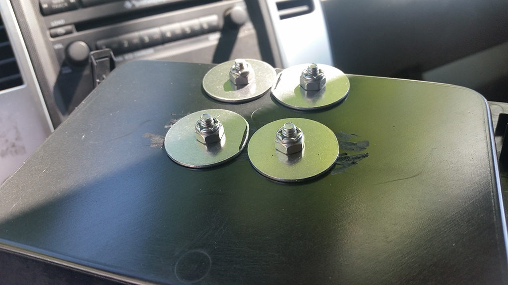
- 4x 10-24×3/4in socket head screws
- 4 x 10-24 locknuts
- 4x 1/4in x 1-1/4in fender washers
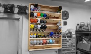
- Dremel with sanding bit (and grinding bit possibly)
- Drill with 7/32in drill bit
- Small piece of foam tape
Nissan dash part (if you want to reverse the install later) – Nissan Part #682529BA0A
I chose parts based on the fact that I was putting using an ASUS TF700 tablet at the time. If you have a more common one such as an iPad or a Samsung tablet they do make specific mounts for some tablets. Also note that they have different mounts for smaller tablets as well as phones that will all mount to the arm I chose, although you may need to purchase additional round bases depending on the mount you choose. These pictures are several years old, and since then I’ve upgraded to a Samsung Galaxy Tab S which also fits the same mount well. I’ll also say, I’ve used RAMs suction mounts and they are heavy duty! So if you’re hesitant about a permanent mount that may be another good option.
Installation
The installation was pretty simple. Assemble the Ram Mount following the instructions. Attach one of the mounting round bases that came with the arm to the tablet mount with the provided hardware.
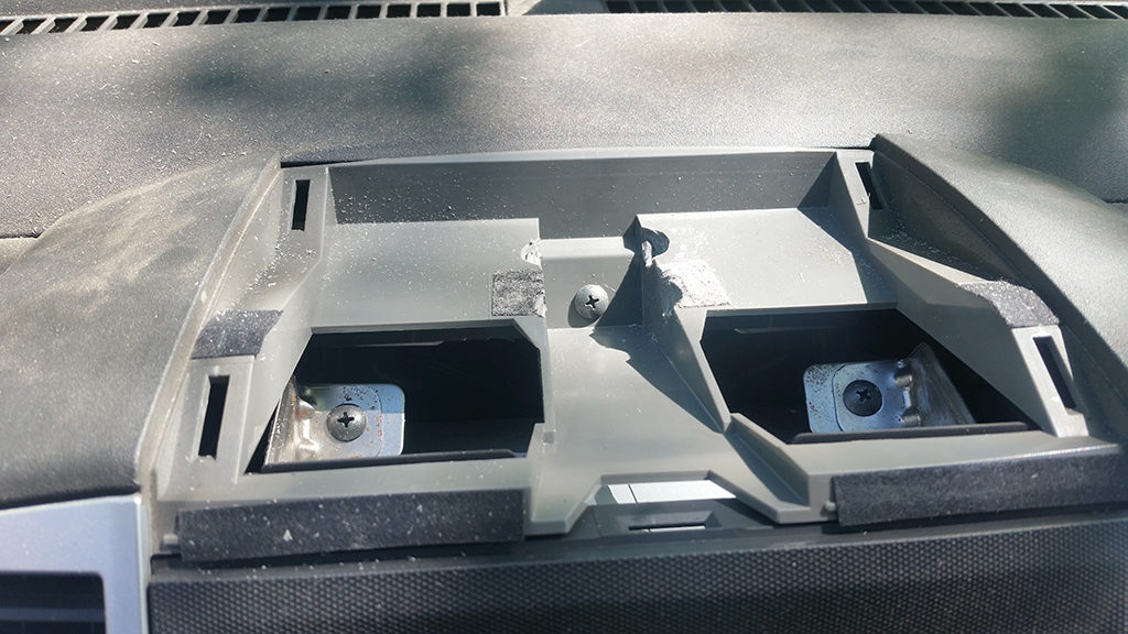
Next pop out the dash bin, and mark and match drill 4 holes (7/32 bit for #10 hardware) to match the holes on the other round base for the long arm. I found that having the base against the back of the bin works fine with this long arm. Also, at this location there were some plastic ribs on the bottom of the bin I hand to dremel away. Attach the base to the dash bin using hardware of your choice. I chose large washers to avoid large point forces on the underside of the bin caused by the cantilevered tablet. This may be overkill and normal washers may work. You’ll notice my washers slightly overlapped so I had to do some minor grinding to give them a flat side.
Next place the bin back over the hole in the dash. There is a little bit of dash that will need to be dremeled so that the nuts/washers/screw threads don’t mash down into them. If you don’t dremel these supports in the dash the dash bin will not go back on.
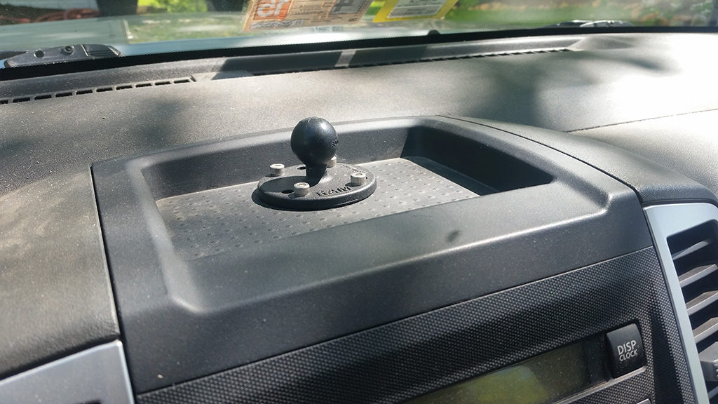
Once all the dremeling is done the dash should fit back down flat and you’ll be left with just the mount in your dash. Next attach the arm and tablet mount assembly. Depending on the angle you keep the arm at it may rub on the front edge of the bin. To fix this just put a small piece of adhesive backed foam on the arm where they rub.
Next, install the tablet and enjoy! Note, although the picture below makes it look like the tablet is high and may block my view, in reality the tablet is almost entirely only covering my view of the hood. I’m 6′ 3″ tall though so others may have different results.
Navigation Apps
I know some people prefer a stand alone GPS device which are still available but a lot of people today don’t bother because you’re essentially buying a small computer with memory and a touch screen, and you already bought one of those when you bought a phone or tablet! For that reason the popularity of GPS apps seem to be exploding everywhere I turn!
I run Android stuff so some of these are Android specific, but the three navigation apps I’ve found most handy are HERE WeGo, BackCountry Navigator, and Maplets.
HERE WeGo
HERE is great for off grid road navigation. It allows you to download the road maps for individual states or whole countries. I use this when we are navigating to Potomac State Forest for instance because from Virginia we’ll cross an area with no cell phone signal and we’ve had issues in the past when that was lost. HERE WeGo solves that, although isn’t as good as say Google Maps, some addresses for instance it doesn’t seem to be able to locate. You can try it for free though. It is available for Android and Apple.
BackCountry Navigator
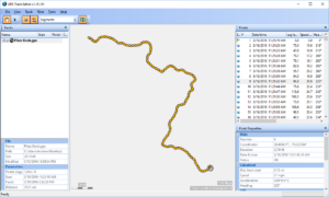
For off road and trail navigation I prefer BackCountry Navigator. Also available with limited functionality for free. It has a lot in common with MotionX for iPhones. What I like about it is that you can download maps from different sources for the area you’re headed to. For instance many areas we frequent have USGS maps that are available such as George Washington National Forest. These maps commonly have contour lines and known routes and are much easier to reference than a pile of big paper maps in some circumstances. This app also allows for recording a GPS track and marking and labeling points of interest along the way. Here is the free version and the full version.
Maplets
Finally I’ll mention the other app I use which is Maplets. This app is handy because certain maps have been uploaded to it that wouldn’t be on the other options. For instance, the Rausch Creek off road park maps are available on Maplets and makes navigating around their parks much easier. Note that this app is no longer available directly from the Google Play store, but is available from the Amazon App store as well as for Apple.
Avenza Maps
One last app that I have only had limited experience with but I plan to use more. Avenza is very similar to Maplets in that it allows you to download maps such as off road park published maps and navigate on their map in real time. At this time the best digital map for AOAA up in Pennsylvania is only available on the Avenza app. This app is only available for Android.
Disclaimer: I participate in the Amazon Affiliate program. By purchasing items listed on Amazon using the links on this website you are supporting this website. I received no compensation for listing or using any of the products linked to on this page.